
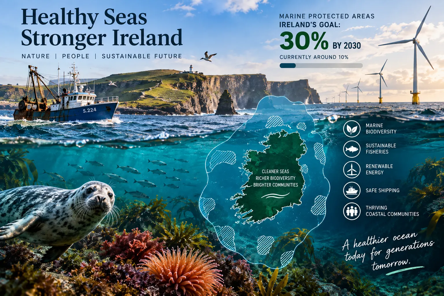
Ireland’s marine planning area covers more than 488,000 square kilometres, around seven times the country’s land area. The Government wants at least 30% of that maritime space protected by the end of 2030, compared with approximately 10% today. On the current planning footprint, 30% would correspond to more than 146,000 square kilometres of sea. Yet these are also waters through which most of Ireland’s physical trade moves, where thousands of people depend on fishing and seafood, and where the State plans one of Europe’s largest expansions of offshore renewable energy.
That is why the debate about Marine Protected Areas is more complicated than drawing green boundaries on a chart. A protected area can restrict fishing, anchoring, seabed disturbance or other activities where those activities threaten the feature being protected, but the Government’s new framework does not propose turning 30% of Irish waters into one enormous exclusion zone. The central question is what needs protection, from which pressures, under which rules and at what cost to people who already use the sea.
The latest step came in July 2026, when the Government approved the General Scheme of the Maritime Area Planning (Marine Protected Areas) (Amendment) Bill 2026 and moved the legislation into drafting. It is a significant milestone, but an important distinction remains: as of early September, this is still a General Scheme rather than an enacted Act. The detailed Bill must proceed through the legislative process, and its provisions can still change before becoming law.
The proposed framework is nevertheless unusually revealing. It shows how Ireland intends to move from a collection of existing European and national nature designations towards a broader system capable of protecting species, habitats, ecosystems and even ecosystem services, while integrating those protections into the same marine spatial-planning machinery increasingly being used for offshore wind.
Ireland’s marine protection challenge
- Ireland’s National Marine Planning Framework covers more than 488,000 square kilometres of maritime area.
- Approximately 10% of Irish seas currently benefit from protected status.
- The Government’s target is at least 30% protection by 31 December 2030.
- Protected coverage stood at only about 2.1% when the major MPA consultation opened in 2021.
- Large designations in the Atlantic, Irish Sea and off Wexford subsequently lifted coverage to almost 10%.
- The new 2026 framework would use Designated Maritime Area Plans, or DMAPs, to establish future MPAs.
- The framework does not automatically prohibit fishing, shipping, offshore wind or public access throughout every MPA.
- Separate conservation measures would be designed around the objectives and pressures of each protected area.
Thirty Per Cent Protected Does Not Mean Thirty Per Cent Closed
The word “protected” can create a misleading picture of a line across the sea beyond which boats, turbines and fishing gear are automatically forbidden. That is not what the July General Scheme proposes. It defines an MPA as a geographically specified part of the maritime area established through a DMAP to achieve long-term conservation objectives involving the protection, conservation, preservation or restoration of marine features.
Those features can include species and habitats, but the proposed definition goes further by including ecosystems and ecosystem services. That matters because a marine area can be valuable not merely because a rare animal lives there, but because it provides nursery habitat, stores carbon, supports food webs, protects coastlines or performs other ecological functions on which people and industries depend.
Once an MPA exists, the Minister would be able to introduce regulations tailored to its conservation objectives. The proposed powers are wide: activities could be restricted or prohibited, vessels could face controls on entry or movement, anchoring and mooring could be limited, animals or plants could be protected from taking or disturbance, and activities that damage the seabed could be regulated.
But those powers do not apply automatically in identical form everywhere. A deep-water reef protected from physical seabed damage may require a different management regime from a seabird feeding area, a coastal habitat, a cetacean area or an ecosystem whose main pressure comes from something else entirely.
This distinction is fundamental. An MPA is a legal mechanism for achieving a conservation objective; it is not necessarily a no-take marine reserve. The current General Scheme also contains no separate statutory percentage requiring 10% of Irish waters to become strictly protected. Environmental organisations have argued for such a target, reflecting wider European biodiversity ambitions, but that advocacy should not be confused with what the July 2026 legislative scheme actually says.
Ireland Already Has Protected Seas — but They Were Built Through a Patchwork
Marine protection did not begin with the proposed MPA legislation. Ireland already protects large areas through the EU Birds and Habitats Directives, principally as Special Protection Areas for birds and Special Areas of Conservation for habitats and species. Wildlife legislation provides other tools, while Ireland also has international commitments under the OSPAR Convention for the North-East Atlantic.
The problem is that these systems were created for different purposes and do not provide one comprehensive national mechanism for identifying, designating, managing and enforcing a broader network of MPAs. The National Parks and Wildlife Service notes, for example, that an OSPAR MPA designation does not on its own create domestic legal protection in Ireland. The State has consequently used existing Special Areas of Conservation as the legal underpinning for a number of its OSPAR sites.
The limitations become more visible when protection is needed for ecological features not easily captured by existing categories. A modern MPA network may need to protect ecological processes, seabed systems, concentrations of mobile species or combinations of habitats and human pressures rather than only features already listed under older conservation legislation.
The 2026 scheme attempts to fill that gap without replacing the existing network. Natura 2000 sites and other qualifying protected areas would continue to count, while the new MPA system would operate alongside them. In some places, designations may overlap because the same sea can be protected under more than one legal mechanism for different reasons.
Four Enormous Designations Changed the Percentage in Only a Few Years
The change in headline coverage has already been dramatic. When the Government opened its major MPA public consultation in February 2021, protected coverage was reported at 2.13% of Ireland’s maritime area. By 2024, it was approaching 10%.
Two exceptionally large Atlantic Special Areas of Conservation were central to that increase. The Porcupine Shelf SAC covers approximately 14,795 square kilometres, while the Southern Canyons SAC covers about 14,434 square kilometres. Both protect offshore reef habitat on a scale far larger than most terrestrial protected sites.
Two major bird areas were also added closer to Ireland’s eastern and south-eastern coasts. The North-West Irish Sea SPA covers more than 2,300 square kilometres, while the Seas off Wexford SPA exceeds 3,000 square kilometres and is the largest Special Protection Area in the State.
Together, the recent additions demonstrate why percentages can move quickly when offshore sites are enormous. They also reveal why area alone is an incomplete measure. Protecting 15,000 square kilometres on a map tells the public how much space has been designated, but not whether the activities threatening the ecological features have actually been identified, regulated and monitored.
The EPA Has Already Warned That Designation and Protection Are Not the Same Thing
Ireland’s Environmental Protection Agency made that point explicitly in its 2024 State of the Environment assessment. It welcomed the increase from roughly 2% to more than 9% but said the actual level of protection remained unclear because management measures had not yet been put in place for all areas.
This is the difference between a statistical target and an ecological result. An area can appear inside a protected-area database while the principal pressure on the habitat continues. Conversely, a well-designed and enforced protected area can deliver significant ecological benefits even if its boundaries are comparatively modest.
The new legislation is therefore attempting to address more than designation. It provides for conservation objectives, management authorities, management plans, reporting, activity-specific regulation and enforcement. The Maritime Area Regulatory Authority, or MARA, would normally play a central management and enforcement role, while coastal local authorities could manage certain nearshore MPAs.
The success of the 30% policy will ultimately depend on those operational details. Ireland can reach a numerical target by increasing the coloured area on marine maps. Achieving ecological recovery requires the right areas, the right conservation objectives and rules strong enough to address the pressures actually affecting them.
Why Ireland Is Seeking More Protection Even Though Much of Its Sea Remains Clean
It would be inaccurate to describe Ireland’s entire marine environment as degraded. The latest comprehensive Marine Strategy assessment presents a mixed picture. Ireland is achieving good environmental status in areas such as eutrophication and hydrographical conditions, and concentrations of most contaminants are generally at levels consistent with environmental protection.
Other indicators are considerably weaker. Biodiversity has achieved good status for some elements, while the position of many species groups remains unknown. The assessment found that none of the four fish biodiversity groups considered had achieved good environmental status.
Commercial stocks also present a complicated picture. Twenty-nine assessed fish and shellfish stocks achieved good environmental status, 46 did not, while the status of another 99 remained unknown. Those figures illustrate both ecological pressure and an important data problem: marine management is often being asked to make long-term decisions in an environment where knowledge is incomplete.
The seabed assessment is similarly mixed. Approximately 75% of the assessed area achieved good environmental status, around 11% did not, and the status of roughly 15% remained unknown. The EPA nevertheless reported that disturbance from bottom trawling was widespread and affected about 40% of the Marine Strategy assessment area to varying degrees.
Marine litter has not achieved good environmental status. The overall picture is therefore not one of a uniformly damaged ocean, but of particular biological, seabed and pollution pressures occurring within seas that are simultaneously supporting healthy conditions in other respects.
Selected Indicators From Ireland’s Latest Marine Assessment
| Indicator | Latest assessment |
|---|---|
| Biodiversity | Good status for some elements; many remain uncertain |
| Commercial fish and shellfish | 29 stocks good; 46 not good; 99 unknown |
| Sea-floor integrity | 75% good; about 11% not good; 15% unknown |
| Bottom-trawling disturbance | About 40% of assessment area affected to varying degrees |
| Eutrophication | Good environmental status achieved |
| Marine litter | Good environmental status not achieved |
| Contaminants | Good status largely achieved for most assessed contaminants |
Source: Environmental Protection Agency and Ireland’s Marine Strategy assessment.
Why a Process Started in 2019 Is Still Not an Act
The long legislative timeline has become part of the MPA debate. The Government began the present expansion process in autumn 2019, when an expert advisory group was established to examine scientific, economic, legal and social questions surrounding a larger protected-area network.
The group submitted its report in 2020 and it was published in January 2021. It made more than 60 recommendations, including the need for dedicated primary legislation. A five-month public consultation followed and produced 2,311 responses, with strong overall support for greater marine protection but sharply different views about how it should affect fishing, aquaculture, offshore energy, transport, recreation and coastal communities.
Government approval to develop a General Scheme followed in August 2022, and a first standalone Marine Protected Areas General Scheme was approved that December. Pre-legislative scrutiny took place in 2023, while ecological sensitivity studies were being developed in parallel.
The expected legislation did not reach the statute book on the timetable anticipated at that stage. By 2024, the EPA was describing the MPA legislation as delayed. Interdepartmental issues, the interaction with fisheries and other marine uses, legal drafting and the wider system of maritime planning all formed part of an increasingly complex policy process.
Then the architecture changed. Responsibility for marine-environment functions moved to the Department of Climate, Energy and the Environment in August 2025. Following a review, the Government decided in November not to continue with a separate third spatial-designation system for MPAs. Instead, it would integrate them into the existing Maritime Area Planning Act 2021 and use its DMAP mechanism.
The process has therefore not simply involved seven years of drafting the same Bill. The State first designed a standalone MPA system and later decided to rebuild the mechanism inside the newer marine-planning system. That may make future planning more coherent, but the redesign itself consumed time while the 2030 deadline continued to approach.
How Ireland’s MPA Framework Reached 2026
| Period | Development |
|---|---|
| 2019 | Government begins MPA expansion process and establishes expert group |
| Jan 2021 | Expert report published with more than 60 recommendations |
| 2021 | Public consultation receives 2,311 responses |
| 2022 | Government develops and approves first standalone General Scheme |
| 2023 | Pre-legislative scrutiny and western Irish Sea sensitivity analysis |
| 2024 | Celtic Sea analysis completed; protected coverage rises towards 10% |
| Aug 2025 | Marine-environment functions transfer to DCEE |
| Nov 2025 | Government changes approach and opts to use the MAP Act and DMAP system |
| Jul 2026 | New General Scheme approved and drafting advanced |
| Q1 2027 | Atlantic ecological sensitivity report expected |
| 2030 | Target date for at least 30% protection |
Sources: Department of Climate, Energy and the Environment and Department of Housing, Local Government and Heritage.
The 2025 Redesign Could Become One of the Most Important Decisions
Using the same planning mechanism for environmental protection and major maritime development is more than an administrative change. A DMAP is a spatial plan for a defined part of the sea. Ireland is already using the system to determine where future offshore renewable energy can be developed.
The new proposal would allow the same statutory machinery to establish MPAs. In theory, that makes it easier to see competing uses together rather than treating conservation, wind, fishing and other activities as separate processes that discover conflicts only after projects have advanced.
It does not remove those conflicts. A biologically sensitive area can still overlap with valuable fishing grounds, a shipping route or a technically attractive wind site. What integration can do is force those interests into the same spatial-planning conversation earlier.
There is also an administrative advantage. Ireland already has a legal framework for DMAP preparation, environmental assessment, consultation and Oireachtas involvement. Reusing it avoids constructing another complete spatial-planning system alongside the National Marine Planning Framework and the offshore-energy DMAP regime.
The weakness is that an environmental protection instrument must not become merely another planning designation. Its credibility will depend on conservation objectives remaining strong enough to determine what activities are compatible, rather than conservation being treated as one interest among many after the boundary has been selected.
The New Marine Policy Statement Would Decide What Ireland Is Looking For
The General Scheme proposes replacing the existing Marine Planning Policy Statement with a broader Marine Policy Statement combining planning and environmental priorities. It would contain criteria for choosing MPAs and identify the marine features that should receive priority for protection, conservation, preservation or restoration.
The proposed criteria are deliberately broad. They include whether features are threatened, declining, vulnerable or rare; ecological importance; representativeness; the degree of disturbance or degradation; the need to protect relatively undisturbed areas; the size required for effective conservation; connections between protected areas; and the activities already occurring at sea.
This is an important shift from simply protecting isolated locations. Ecological coherence matters because marine species move, currents connect distant habitats and damage in one location can affect ecological processes elsewhere. A collection of disconnected protected fragments may perform very differently from a planned network.
The scheme also proposes an interim list of priority marine features so that designation work does not have to wait for the next full Marine Policy Statement. That list would draw explicitly on the western Irish Sea, Celtic Sea and forthcoming Atlantic ecological sensitivity analyses.
The 30% Target Is Stronger Than Policy Alone — but Its Draft Wording Is Nuanced
Head 7 of the General Scheme would require the first relevant Marine Policy Statement to include a target that the Minister shall endeavour to ensure that, by 31 December 2030, not less than 30% of the maritime area is protected as a protected area or otherwise. The methodology for deciding what counts would have to reflect best available science and national or international best practice.
The wording matters. It is not a simple instruction to designate exactly 30% of the sea as brand-new MPAs. Existing Special Areas of Conservation, Special Protection Areas and other qualifying protected areas can contribute towards the total, while the phrase “or otherwise” provides scope for other protection that meets the required methodology.
Nor does the scheme state that every square kilometre counted towards 30% must have the same level of restriction. The target is therefore a coverage objective within a wider management system rather than a requirement to impose one standard rule on nearly one-third of Irish waters.
For readers, this means two future statistics will matter. The first is how much of Ireland’s maritime area officially counts towards the target. The second, harder question is what conservation measures actually apply inside those areas.
There Is No Final Map of the New 30% Yet
The Government has already carried out substantial ecological screening, but it has not published a final map showing the future MPA network. That is an important distinction because sensitivity-analysis maps identify areas with potential; they are not themselves statutory MPA boundaries.
The first major study examined the western Irish Sea and was completed in 2023. The next covered the Celtic Sea and was published in June 2024. Both were designed to identify ecological sensitivity while taking account of available information about existing activities, including fishing, shipping and the rapidly developing offshore-energy sector.
The third major analysis covers Atlantic waters. Work is continuing through 2026, with the final report expected in the first quarter of 2027. Together, the three studies are intended to provide a Stage 1 assessment across Ireland’s maritime area from which future proposals can be developed.
This means eastern and south-eastern waters in the Irish Sea, the Celtic Sea off the south coast and Ireland’s much larger Atlantic waters are all part of the evidence-building process. It does not mean that every high-sensitivity area appearing in those studies will become an MPA.
Under the proposed law, potential sites would still have to be assessed against formal selection criteria. Their ecological, economic, social and cultural significance would have to be considered, boundaries and conservation objectives developed, environmental assessment undertaken where required and public consultation completed before designation.
The Atlantic Will Decide Whether 30% Is Mostly Offshore or Close to Communities
The enormous scale of Ireland’s western maritime area creates several possible pathways to the 30% target. Very large offshore designations can increase national coverage rapidly while directly affecting relatively few coastal residents. The Porcupine Shelf and Southern Canyons SACs already demonstrate how quickly tens of thousands of square kilometres can be added offshore.
But an ecologically representative network cannot be designed solely around where protection is easiest to designate. Inshore bays, estuaries, shallow seas, spawning areas, bird feeding grounds and coastal habitats can face more intense human pressure precisely because they are close to communities and economic activity.
Protecting a remote deep-sea habitat may therefore be necessary without being a substitute for protecting a vulnerable coastal ecosystem. The eventual network has to reflect ecological need rather than simply maximise area at the lowest political cost.
This is one reason the Atlantic analysis and formal selection criteria are so important. The national percentage can be achieved in many geographic combinations. Only some combinations are likely to produce an ecologically representative and connected network.
Offshore Wind Is Expanding in the Same Waters
No other new use of Irish marine space illustrates the planning challenge as clearly as offshore wind. Ireland still has a near-term goal of approximately 5GW of offshore wind associated with its 2030 programme, while long-term policy targets 20GW by 2040 and at least 37GW by 2050.
These figures imply development on a scale far beyond Ireland’s existing offshore-energy sector. Turbines require suitable wind resources, water depths and seabed conditions, but projects also need cable routes, grid connections, construction access, ports and areas capable of satisfying environmental and planning requirements.
The South Coast DMAP has already identified four areas in the Celtic Sea for fixed offshore wind. Its first site, Tonn Nua off County Waterford, covers 306 square kilometres and was the subject of Ireland’s second offshore-wind auction. A 900MW project was awarded in December 2025.
The remaining South Coast areas and the developing National ORE DMAP extend the spatial challenge much further. The national plan is intended to identify sufficient marine space around Ireland’s coast to support the 20GW ambition by 2040 when combined with projects already advancing through earlier phases.
Ireland is therefore attempting two major spatial transformations simultaneously: rapid expansion of protected areas and rapid expansion of offshore energy. Both have 2030s deadlines and both depend on ecological information, seabed data, ports, communities and consent processes that are still developing.
An MPA Is Not Automatically a No-Wind Zone
It would be equally misleading to assume that an offshore wind project and an MPA can never occupy the same broader marine space. Compatibility depends on what is being protected and which pressures the project creates.
A proposed wind farm can affect the marine environment through foundation installation, seabed disturbance, construction noise, cable works, vessel traffic and, depending on location and species, possible effects on seabirds or marine mammals. Those impacts are highly site-specific and must already be considered through environmental assessment and the planning process.
An MPA adds another layer: the project’s effects would have to be compatible with the area’s conservation objectives and any specific regulations. If the protected feature is particularly vulnerable to seabed disturbance, development may be inappropriate or require significant redesign. In another MPA, certain activities could potentially coexist with the conservation objective.
The new system is therefore not designed simply to place “nature” on one map and “wind” on another. The more difficult ambition is to identify locations where energy development can proceed while avoiding or minimising damage to sensitive ecosystems, and to recognise early where coexistence is unrealistic.
The South Coast Has Already Become a Test of Coexistence
The South Coast DMAP was developed with explicit policy objectives around coexistence between offshore energy and other marine users. The Government has described its obligations on developers to facilitate coexistence with fishing as unusually strong by European standards.
Implementation work has also examined vessel activity because wind farms cannot be planned as though commercial shipping and fishing vessels do not exist. Twelve months of vessel-traffic data have been analysed to identify areas of high activity and potential constraints within the South Coast plan.
That approach is relevant to future MPAs because spatial pressure will increase as both systems expand. A protected area that pushes fishing effort into an offshore-wind zone, or a wind zone that displaces vessels into a sensitive habitat, can simply move conflict rather than solve it.
The challenge is therefore cumulative rather than project-by-project. Ireland needs to understand not only what one designation does at one location, but what happens when several protected areas, wind projects, cable corridors, shipping routes and fishing grounds interact across an entire sea basin.
Fishing Is Likely to Be the Most Sensitive Economic Trade-Off
For fishing communities, access to marine space is not an abstract planning issue. It determines where vessels can operate, how far they must travel, what species can be caught and whether smaller boats can remain economically viable from particular ports.
The sector is already entering 2026 under pressure unrelated to the new MPA legislation. BIM’s latest quota analysis puts Irish fishing opportunities at a little over 120,000 tonnes with an estimated first-sale value of €205 million, around 60,000 tonnes and €102 million lower than in 2025. These reductions principally reflect fisheries-management and stock decisions, not MPAs, but they form the economic backdrop against which additional spatial restrictions would arrive.
The wider seafood sector directly employs 7,509 people and supports close to 16,000 jobs when upstream activity is included, according to BIM’s latest Business of Seafood report. Seafood accounts for a particularly important share of employment in some coastal regions, making geographically concentrated impacts much more significant than national averages suggest.
A restriction that appears small when measured against Ireland’s entire 488,000-square-kilometre maritime area can therefore be substantial if it covers a highly productive fishing ground used by vessels from one harbour. The national environmental gain and the local economic cost can occur in very different places.
The Proposed Law Gives Fisheries a Specific Institutional Safeguard
The General Scheme recognises that fisheries management already operates through a dense body of Irish and European law. Before making MPA regulations that would prohibit or restrict activities undertaken under relevant fisheries legislation, the Minister for Climate, Energy and the Environment would have to seek the consent of the Minister for Agriculture, Food and the Marine.
The scheme also requires consultation with the Agriculture Minister more generally when MPA regulations are being developed, and additional fisheries consultation is envisaged for areas outside Ireland’s territorial sea where the Common Fisheries Policy has particular relevance.
This does not give every individual fishing operation a veto over protection. It does ensure that restrictions affecting fisheries cannot simply be designed as though the existing fisheries-management system does not exist.
That coordination can protect legitimate economic interests and improve technical design. It can also make decision-making slower where environmental and fisheries objectives conflict. The same institutional complexity that contributed to the long development of the legislation will not disappear after the Act is passed.
A Poorly Designed MPA Can Move Fishing Pressure Rather Than Reduce It
Displacement is one of the central practical problems in marine conservation. If fishing is restricted in one productive area but total fishing effort remains unchanged, vessels may move elsewhere. That can increase pressure on neighbouring grounds, raise fuel use and create congestion or competition among fleets.
The effect can be particularly difficult for smaller vessels because they have less ability to travel long distances in search of alternative grounds. A restriction located far offshore may therefore affect a large industrial vessel differently from an inshore boat operating within a limited safe and economic radius of its home port.
This is why the scale, location and management of a network matter more than the existence of one isolated reserve. Spatial planning can model where displaced activity is likely to go and whether neighbouring habitats can absorb the additional pressure.
Well-designed protection can also work in the opposite direction. Protecting spawning, nursery or heavily disturbed habitats can improve ecological condition and, in some fisheries and circumstances, contribute to greater biomass beyond protected boundaries. But such benefits depend on species mobility, habitat, enforcement, fishing pressure and the design of the MPA; they should not be promised as an automatic increase in future catches.
For Fishers, Participation Before a Boundary Is Drawn Matters More Than Consultation Afterwards
The 2021 public consultation repeatedly identified early and meaningful engagement with the fishing industry, island communities and coastal businesses as essential. That is partly because fishers possess information that does not always appear in national databases: seasonal grounds, weather-dependent routes, nursery observations and the practical limitations of different vessel types.
Consultation after a preferred boundary has effectively been decided tends to become a conflict about compensation or opposition. Co-design at an earlier stage gives communities a chance to explain which areas are operationally critical and where alternative boundaries or measures might achieve similar ecological objectives at lower economic cost.
This does not mean science should be subordinated to whoever uses an area commercially. It means biological evidence and human-use evidence have to be considered together if the State wants rules that can be enforced and maintained over decades.
The General Scheme explicitly requires the ecological, economic, social and cultural significance of a potential MPA to be considered. That provision may become one of the most important parts of the legislation for coastal communities.
Shipping Cannot Simply Be Diverted Around Every Sensitive Area
Fishing is not the only activity constrained by geography. Approximately 90% of goods traded by Ireland move through the commercial port network, making reliable maritime transport fundamental to an island economy. Shipping routes into Dublin, Cork, Shannon Foynes, Rosslare and other ports therefore carry national economic significance.
The proposed MPA powers are broad enough to regulate vessel movement and anchoring where conservation objectives require it. The Minister would also have to consult the Minister for Transport when relevant regulations are prepared.
Again, designation does not imply that commercial ships would be prohibited from every MPA. Transit through some protected areas may create little conflict with the feature being conserved, while anchoring, dredging or repeated seabed disturbance may present much greater risks in another location.
This is where targeted management becomes economically important. A system capable of regulating the damaging pressure rather than automatically banning every maritime activity can preserve both ecological value and essential connectivity where the two are genuinely compatible.
Ports Will Become Part of the Offshore-Wind Economy Too
The boundary between shipping and energy policy is also becoming less distinct. Offshore wind requires ports capable of handling enormous components, construction vessels, maintenance operations and future floating-wind technology. Several Irish ports are therefore examining or undertaking major infrastructure investment linked to renewable energy.
A badly coordinated marine-protection system could constrain port approaches or cable routes at the same time as national policy asks the same ports to support the energy transition. The reverse problem also exists: expanding ports and industrial maritime activity without sufficient ecological planning can damage habitats whose restoration later becomes more expensive or impossible.
Integrated marine planning is intended to address such conflicts before billions of euro are committed. The same principle applies to undersea electricity interconnectors and communications cables, which have national strategic importance but can require seabed works across sensitive areas.
Protection and infrastructure therefore cannot be planned sequentially, with one sector claiming space first and the others attempting to fit around it. They increasingly have to be designed from the same evidence base.
Coastal Communities Could Gain From Protection — but the Benefits Will Not Be Evenly Shared
The potential benefits of better-protected seas extend beyond biodiversity. Healthy marine ecosystems support recreation, wildlife tourism, fisheries, water quality and coastal identity. Habitats can also provide ecosystem services such as nutrient regulation, natural carbon storage and resilience to environmental change.
A community near an attractive protected coastal area may benefit from tourism or improved environmental quality. Another community may primarily experience restrictions on fishing or development and see few immediate compensating gains. National environmental benefits can therefore coexist with highly localised economic losses.
This distributional problem is central to public acceptance. It is easier to support 30% marine protection as a national principle than to support a specific boundary when it includes a harbour, customary fishing ground, aquaculture site or location expected to provide future employment.
The policy challenge is not to pretend that every stakeholder will win from every designation. It is to identify impacts honestly, reduce avoidable damage, support adaptation where necessary and distinguish genuine economic dependence from claims that any new environmental rule is automatically incompatible with development.
Compensation Exists in the Proposal — but It Is Not a General Guarantee Against Loss
The General Scheme contains a compensation mechanism for certain existing proprietary interests where those interests are effectively removed by MPA regulations. The qualifying concept can include specified rights, leases, licences, permits, approvals and other legally recognised interests.
This is significant because marine regulation can affect assets that were granted lawfully before an MPA existed. Aquaculture permissions, certain maritime consents and other established rights may have real economic value that cannot simply be ignored when regulation changes.
But the provision should not be interpreted as a promise to compensate everybody whose income is indirectly affected. A fisher who experiences displacement, a business that loses anticipated future activity or a community concerned about wider economic effects may not possess the type of proprietary interest contemplated by the scheme.
The economic assessment of MPAs will therefore remain broader than the legal compensation system. Some costs can be compensated directly; others may need transition assistance, alternative opportunities or changes to the design of the protected area itself.
A €25 Million Research Programme Is Trying to Put Communities Into the Design Process
Ireland has already begun a nine-year programme intended to support the expansion before all the legislation is complete. MPA LIFE Ireland runs from 2024 to 2033 with €15 million in EU LIFE funding and a further €10 million in State co-financing.
The project brings together the Department with University College Dublin, University College Cork and the University of Galway. The division of work reflects the multidimensional nature of marine protection: UCD focuses on ecological questions, UCC on social and stakeholder issues, and Galway on economic impacts on industries and communities.
This is important because the 2030 target arrives three years before the LIFE programme itself ends. Designation will therefore not conclude the process. Management, monitoring, evaluation and adjustment are expected to continue well into the following decade.
The programme also provides a practical test of co-design. If future MPAs are developed with fishers, coastal communities, researchers, environmental groups and marine industries rather than presented as completed maps, the State may be able to identify conflicts earlier and build more durable management arrangements.
Marine Science Is Becoming a Form of Economic Infrastructure
The ability to choose sensible locations depends on knowing what is beneath and above the water. Ireland’s marine area is vast, deep and comparatively expensive to survey. Knowledge of offshore habitats, seabed geology, species distribution and vessel activity is consequently uneven.
Programmes such as INFOMAR, ObSERVE and the ecological sensitivity studies are filling that gap. Better seabed mapping helps conservation planning, but it also supports fisheries, offshore energy, cables, navigation and infrastructure design.
This creates an unusual situation in which environmental research can reduce commercial risk. If a developer discovers a critical habitat after years of engineering work, relocation can be extremely expensive. Identifying sensitive areas before auctions or planning applications allows both protection and development to become more predictable.
The same applies to fishing. Better information about spawning grounds and habitats can improve conservation design while helping distinguish areas where restrictions would produce meaningful ecological benefits from those where they would impose cost with limited environmental return.
The Western Irish Sea and Celtic Sea Studies Are Screening Tools, Not Secret Designation Maps
The ecological sensitivity analyses have sometimes been discussed as though they show where the Government has already decided to place future MPAs. Their official purpose is more preliminary. They combine ecological information to identify areas potentially suitable for further consideration and to inform future site selection.
The western Irish Sea study is particularly significant because those waters already contain intense existing and proposed uses, including fisheries, commercial shipping and offshore renewable energy. The Celtic Sea study faces a similar challenge along the south coast, where the first plan-led wind sites have now been established.
The Atlantic analysis will extend the process into a much larger and less intensively surveyed region. It is expected to complete the first national screening stage when its report is published in 2027.
Future designation still requires the statutory process. That includes site-specific conservation objectives, maps and coordinates, consideration of human uses, environmental assessment where required, consultation and ultimately the legal adoption of the relevant DMAP.
The Government Could Protect a Large Area and Still Miss the Most Important Habitats
Percentage targets create an obvious incentive to count area. Marine ecology creates an equally strong reason not to confuse size with representativeness.
A network concentrated in remote waters could protect enormous surface area while leaving heavily pressured coastal ecosystems, important nursery grounds or migratory routes underrepresented. Conversely, focusing only on known coastal hotspots could fail to protect deep-water ecosystems that are rare, slow to recover and vulnerable to physical disturbance.
The General Scheme attempts to guard against this by requiring attention to rarity, vulnerability, ecological importance, representativeness, adequate size and connectivity between protected areas. Those criteria are at least as important as the 30% headline.
The public will therefore need more information than an annual national percentage. A credible network should eventually be capable of showing what ecological features are represented, what pressures each MPA addresses, what management rules apply and whether environmental condition is improving.
Monitoring Will Decide Whether an MPA Works
Marine ecosystems change slowly, and some are extremely difficult to observe. A protected reef hundreds of metres below the surface cannot be assessed by ordinary public observation, while mobile species may spend only part of their life cycle inside an MPA.
Effective monitoring therefore requires long-term surveys, vessel data, biological sampling and increasingly remote technologies. Baseline information is especially important: without knowing the condition of an ecosystem when protection begins, it becomes difficult to prove whether a later improvement or decline resulted from management.
Management also has to be adaptive. Climate change is altering ocean temperatures, species distributions and ecological relationships. A boundary designed around today’s distribution of a mobile species may become less effective over several decades.
The proposed ten-year DMAP review cycle provides a formal mechanism for reconsideration, while MPA management reports could provide more regular evidence. Long-term legal protection should not mean static management when the ecosystem itself is changing.
Enforcement Is Where a Paper MPA Becomes a Real One
A regulation restricting damaging activity has little ecological value if breaches cannot be detected or sanctioned. Ireland’s maritime area is too large for traditional patrol methods alone to provide constant oversight.
The General Scheme therefore gives MARA a default enforcement role while allowing other authorities, including Inland Fisheries Ireland, coastal planning authorities and the Permanent Defence Forces, to be appointed in appropriate circumstances. Existing fisheries enforcement structures would continue to matter as well.
Modern surveillance can combine vessel-monitoring systems, satellite data, automatic identification signals, aerial observation and physical inspections. Different technologies have different coverage and legal limitations, particularly because not every small vessel transmits the same tracking information.
Enforcement capacity will consequently become part of the cost of reaching 30%. A larger protected network creates additional responsibilities for the State after the designation announcement has been made.
The Economics of Marine Protection Run in Both Directions
Environmental regulation is often described principally through the cost it imposes on an activity. MPAs can indeed create real costs: displaced fishing, longer steaming distances, planning restrictions, additional environmental assessment, monitoring obligations and limits on certain forms of development.
Degraded marine ecosystems impose costs too. Collapsing stocks reduce fishing opportunities, habitat loss can diminish ecosystem resilience, declining wildlife can affect tourism and poor environmental condition can require expensive restoration or constrain later development.
The difficult analytical task is that the two categories of cost occur on different timelines. A fishing restriction can reduce income immediately, while recovery of a habitat may take years. An offshore project relocated away from a sensitive area incurs a visible development cost, while the value of avoiding ecological damage is harder to place on a company balance sheet.
That asymmetry is one reason environmental decisions become politically difficult. Short-term losses are often concentrated and measurable. Long-term ecosystem benefits are dispersed across communities, industries and future generations.
Healthy Seas Are Not the Opposite of a Blue Economy
Ireland’s economic ambition for the sea is expanding rather than contracting. Government policy envisages offshore wind, ports, aquaculture, seafood, tourism, marine technology and energy infrastructure contributing to a much larger blue economy.
That growth makes environmental protection more important, not less. Marine space that once experienced relatively limited industrial pressure could host turbines, cables, survey vessels and expanded port activity while continuing to support fisheries and shipping. Without spatial planning, cumulative effects can emerge even when each individual project appears manageable in isolation.
A functioning MPA network can therefore provide economic certainty as well as restriction. Developers know which areas contain particularly sensitive features before committing large sums. Fishers can have greater clarity about long-term protected grounds. Public bodies can make decisions against an established environmental framework rather than attempting to resolve every conservation question during each individual consent application.
The benefit depends on stability and credibility. Constantly changing boundaries, weak scientific justification or designations without effective management would create uncertainty rather than reduce it.
Offshore Wind and MPAs Share a Common Dependence on Public Trust
Both programmes ask coastal communities to accept major decisions about space traditionally perceived as open and shared. Wind development allocates areas for industrial infrastructure. MPAs can restrict activities that communities may have practised for generations.
If either system is perceived as arriving from Dublin with predetermined maps and little meaningful local influence, opposition becomes more likely regardless of the technical merits. The extensive consultation built into the DMAP process is intended to reduce that risk.
The General Scheme proposes additional consultation before activity-specific MPA regulations are introduced, including periods in which draft regulations are publicly available and submissions can be made. Holders of known proprietary interests would also have to be notified.
Consultation cannot mean that every participant receives their preferred outcome. Its value is that conflicts, local knowledge and alternative solutions are identified before rules become final, and that the reasons for difficult decisions can be tested publicly.
The 30% Target Comes From More Than One International Commitment
Ireland’s policy does not exist in isolation. The EU Biodiversity Strategy for 2030 calls for 30% of EU sea area to be protected. OSPAR has adopted a 30% objective for the North-East Atlantic, while the Kunming-Montreal Global Biodiversity Framework agreed under the UN Convention on Biological Diversity established a global ambition to conserve 30% of coastal and marine areas by 2030.
There is also a more specific European legal obligation. The Marine Strategy Framework Directive requires programmes of measures to include spatial protection contributing to coherent and representative networks of marine protected areas as part of the effort to achieve good environmental status.
The percentage is therefore politically important, but ecological effectiveness remains built into the international concept. Thirty per cent of poorly managed ocean does not satisfy the underlying environmental purpose simply because a map has reached the correct colour ratio.
Ireland will ultimately be judged not only by whether it reaches the numerical threshold, but whether protected areas are coherent, representative, managed and capable of achieving their conservation objectives.
Ireland’s High-Seas Obligations Are Expanding at the Same Time
The domestic MPA process concerns Ireland’s maritime jurisdiction, but international ocean governance is changing beyond national waters too. Ireland ratified the UN Agreement on Biodiversity Beyond National Jurisdiction in September 2025, and the agreement entered into force internationally in January 2026.
The treaty creates mechanisms through which protected areas can be established on the high seas, where no single country exercises ordinary national jurisdiction. This matters to Ireland because Atlantic ecosystems and migratory species do not stop at the edge of the Exclusive Economic Zone.
Domestic and international protection therefore increasingly form parts of the same ecological system. A whale, seabird or migratory fish may move through Irish waters, neighbouring states’ waters and the high seas during one life cycle.
That reinforces the rationale for connected protected networks rather than isolated national reserves.
What Happens to Recreational Boating, Angling and Tourism?
Recreational use is another area where the phrase “protected area” can cause unnecessary confusion. The proposed legislation gives Government the ability to regulate entry, vessels, anchoring, disturbance of wildlife and removal of material, but it does not prescribe that all recreation must be excluded from every MPA.
In some sensitive coastal habitats, anchoring could be more ecologically significant than the simple passage of a boat. Wildlife disturbance could require seasonal or distance-based controls. Angling might be compatible in one area while inconsistent with the conservation objective of another.
Tourism can also benefit from protection where improved wildlife abundance or environmental quality increases the attractiveness of diving, wildlife watching or coastal recreation. That opportunity was repeatedly identified during the 2021 public consultation.
Growth in tourism can itself create pressure, however. More boats, visitors and wildlife encounters can undermine the ecosystem that protection helped make attractive. Successful MPAs therefore have to manage beneficial uses as well as prohibited ones.
Aquaculture Presents a Different Form of Spatial Dependence
Aquaculture operators cannot simply move an established shellfish or finfish site to another coast. Water quality, currents, depth, exposure, licences and existing infrastructure constrain locations, which makes changes to spatial regulation economically significant.
The General Scheme includes aquaculture legislation within the fisheries-related framework that must be considered when restrictions are proposed. Existing qualifying licences can also be relevant to the compensation provisions if regulations remove a recognised proprietary interest.
As with offshore wind, the ecological relationship is not uniform. Different aquaculture systems create different pressures and can interact differently with the features an MPA is designed to protect.
The future system therefore needs to avoid assumptions that an entire economic category is either always compatible or always incompatible with conservation. Site-specific evidence remains the essential test.
Climate Change Makes Permanent Boundaries More Complicated
Marine protection is usually drawn with fixed coordinates, while the ocean is a dynamic system. Warming waters can change where fish spawn, where plankton develops and which species occupy particular habitats. Ocean acidification can alter ecological conditions even inside areas protected from local human disturbance.
This means MPAs cannot shield ecosystems from every threat. A protected reef cannot prevent global greenhouse-gas emissions from altering water chemistry. A seabird reserve cannot guarantee food availability if prey distribution shifts outside its boundaries.
Protection can nevertheless improve resilience by reducing pressures that can be managed locally. An ecosystem not simultaneously stressed by physical damage, pollution and excessive disturbance may be better placed to withstand climatic change than one already degraded.
This is why the current scheme includes restoration and ecosystem services alongside conventional species protection. Future MPAs may increasingly be judged by their ability to maintain ecological function in a changing ocean rather than preserve a frozen historical condition.
The Deadline Is Close Enough That Site Work Must Begin Before the Legislative Story Is Finished
There are only a little more than four years between the publication of the July 2026 General Scheme and the end-2030 target. Ireland still has to complete legislative drafting, pass the law, establish interim priorities and later the Marine Policy Statement, convert ecological screening into site proposals, consult stakeholders, conduct necessary environmental assessment and establish management measures.
That is why scientific and engagement work has continued in parallel rather than waiting for the Act. The western Irish Sea and Celtic Sea studies are already complete, Atlantic work is under way and MPA LIFE Ireland is testing collaborative processes.
The approach carries some risk because policy work completed before final legislation may need adjustment if the Oireachtas changes the statutory framework. Waiting until every legal detail is settled, however, would leave even less time to reach 30% responsibly.
The Government is effectively attempting to build the evidence pipeline while constructing the legal mechanism that will later use it.
2027 Could Be the Year the Conservation and Energy Maps Begin to Converge
Several major planning processes are due to mature around the same period. The Atlantic ecological sensitivity study is expected in the first quarter of 2027. Development of the National ORE DMAP is continuing through an extensive spatial and consultation process intended to support the 2040 offshore-energy target.
If the MPA legislation is enacted, these datasets and plans will increasingly have to inform one another. The State will know much more about potential conservation priorities at the same time as it narrows the locations for future wind development.
This is potentially the strongest argument for the 2025 decision to use a common DMAP framework. It creates the possibility of resolving major spatial conflicts strategically rather than leaving individual planning applications to discover them one project at a time.
But a shared mechanism does not guarantee a shared outcome. The quality of the underlying science, transparency of trade-offs and willingness to exclude development from genuinely incompatible areas will determine whether integration becomes more than administrative efficiency.
The Hardest Question Is Not Where to Draw the Line but What Happens Inside It
Once Ireland reaches 30%, political attention could easily move to the next target. Ecologically, that would be premature. The real test begins after designation.
Every important MPA should eventually answer a simple set of questions: what is being protected, what condition is it in, what threatens it, which activities remain permissible, who is responsible for management, how compliance is monitored and what evidence would show that the conservation objective has been achieved.
Where those answers are vague, a protected area risks becoming primarily cartographic. Where they are specific and measurable, regulators, industries and communities have a clearer basis for planning around the rules.
The proposed management plans and reporting obligations therefore deserve as much scrutiny as the national coverage percentage. They are less headline-friendly, but far more closely connected to whether marine biodiversity actually improves.
There Will Be Places Where Coexistence Is Possible — and Places Where It Is Not
The language of balance can itself become misleading if it implies that every conflict has a compromise in which all activities continue unchanged. Some sensitive habitats can coexist with shipping passing overhead but not repeated anchoring. Some species may tolerate particular fishing methods but not others. Certain wind developments may be redesignable; others may simply be incompatible with the conservation objective at a chosen location.
Good marine planning therefore requires the ability to say both yes and no. Treating every economic use as automatically unacceptable would ignore the social and economic importance of the sea. Allowing every existing or proposed activity to continue everywhere would make the concept of protection meaningless.
The new framework is intended to provide that graduated decision-making. Its success will depend on whether regulations are sufficiently precise to target harmful pressures without creating unnecessary restrictions, and sufficiently strong to exclude activities when the evidence shows that coexistence is not credible.
For Coastal Ireland, the Transition Will Be Experienced Locally
The national debate uses percentages, gigawatts and square kilometres. Coastal communities experience marine policy through boats, harbours, seasonal work, landscapes, tourism businesses and family histories connected to the sea.
A future MPA off Donegal may raise very different economic and cultural questions from one in the Celtic Sea, Dublin Bay or the Atlantic beyond Kerry. The vessel types are different, the habitats are different and alternative employment or fishing opportunities are not distributed evenly around the coast.
That makes regional impact assessment essential. A national claim that the seafood sector can adapt tells little about whether one small harbour can adapt. A national claim that offshore wind creates employment tells little about whether the jobs appear in the community accepting the greatest spatial change.
The most durable MPA system is therefore likely to be one that treats communities as part of marine management rather than as external stakeholders invited to comment on it.
A Larger Protected Network Could Make Ireland’s Seas More Valuable, Not Less Used
Protection is sometimes framed as the removal of marine space from the economy. A more accurate description is that it changes the conditions under which that space can be used.
Some areas may indeed experience strict restrictions because their ecological features cannot tolerate existing pressures. Others may continue supporting fishing, tourism, transit or carefully assessed infrastructure. Restoration can also create future economic value where degraded habitats recover and support productive ecosystems.
The economic logic resembles maintaining other forms of infrastructure. Exhausting the natural system can generate short-term output while reducing future capacity. Protecting ecological capital can impose present costs while preserving services on which later economic activity depends.
The difficulty is that marine ecosystems do not produce simple accounts showing annual depreciation and return on investment. Governments therefore have to make decisions under uncertainty, often before ecological decline becomes economically undeniable.
The 30% Figure Will Be Easy to Measure; Fairness Will Be Harder
By 2030, it should be possible to calculate the proportion of Irish maritime space that qualifies as protected. It will be much harder to quantify whether the transition was fair.
Fairness involves who gives up access, who receives compensation, who gains from improved ecosystems, which regions receive offshore-wind employment, whether small-scale fishers are disproportionately affected and whether future generations inherit a healthier sea.
These are partly economic questions and partly political choices. Science can identify ecological sensitivity but cannot determine how society should distribute all the associated costs.
The purpose of consultation, socio-economic research and transparent planning is therefore not merely to collect opinions. It is to expose those distributional choices before they become permanent.
What Happens Next
The immediate next step is legislative rather than geographic. The approved General Scheme must be converted into detailed legislation and proceed through the Oireachtas. Until that happens, Ireland does not yet have the new general statutory MPA mechanism envisaged by the July proposals.
If enacted substantially in its present form, the Minister would prepare an interim list of priority marine features, review the maritime area for potentially suitable sites and begin developing MPA DMAPs. The western Irish Sea and Celtic Sea studies could feed directly into that process, followed by the Atlantic analysis expected in 2027.
Each future proposal would have to identify a geographic area and conservation objectives. Management responsibilities, recommended measures, consultation and environmental assessment would follow, with separate regulations available where activities need to be restricted to meet those objectives.
At the same time, the National ORE DMAP will continue identifying sites for Ireland’s next generation of offshore wind projects. Fisheries will continue adapting to changing stocks and quota availability, while ports and shipping remain essential to the physical economy.
These processes will collide if they are treated separately. If the integrated planning model works as intended, they should instead begin shaping one another.
Ireland’s Choice Is Not Between an Empty Sea and an Industrial One
The debate is sometimes reduced to opposing visions: conservationists seeking to lock the sea away and industries seeking unrestricted access. Neither accurately describes the task facing Ireland.
The State is preparing to place much more marine space under environmental protection while simultaneously asking the same maritime area to provide food, trade routes, energy, communications, tourism and employment. Those objectives can coexist in many places, but not everywhere and not without limits.
That is why the quality of the new MPA system matters more than the slogan “30 by 30”. A scientifically weak network could reach the percentage while protecting the wrong places. An over-restrictive system could impose unnecessary economic damage and lose community support. A poorly enforced network could do both: create costs for legitimate users without delivering ecological recovery.
The opportunity is more ambitious. Ireland can use the next four years to move from fragmented designations towards a coherent marine network in which the most sensitive ecosystems receive meaningful protection, sustainable uses continue where compatible and major new developments are directed towards areas where their environmental costs can be managed.
If that works, 30% protection will not mean withdrawing from the sea. It will mean deciding, for the first time through a comprehensive national system, which parts of a vast shared resource need different rules so that the other 70% — and the people who depend on all of it — remain viable for decades to come.
Sources
Department of Climate, Energy and the Environment — Marine Protected Areas Legislation, July 2026
Department of Climate, Energy and the Environment — Marine Protected Areas
Department of Climate, Energy and the Environment — Ireland’s Marine Strategy Part 1
Environmental Protection Agency — Ireland’s State of the Environment 2024: The Marine Environment
National Parks and Wildlife Service — OSPAR Marine Protected Areas
Government of Ireland Open Data — National Marine Planning Framework Area
Department of Climate, Energy and the Environment — National DMAP for Offshore Renewable Energy
Bord Iascaigh Mhara — Business of Seafood 2025
Bord Iascaigh Mhara — Irish Fishing Opportunities and Quotas for 2026
Department of Housing, Local Government and Heritage — MPA Public Consultation Results
Department of Housing, Local Government and Heritage — €25 Million MPA LIFE Ireland Programme
Source & Transparency
This article is published by Ireland Newspaper for editorial and informational purposes.
Published: 4 September 2026 · Updated: 4 September 2026

Newsroom Ireland Newspaper
Ireland Newspaper editorial team prepares daily news coverage for readers in Ireland and abroad.