Storm Warnings in Ireland: The Emergency & Crisis Guide for Residents and Visitors
Ireland’s Atlantic position means severe wind, heavy rain, coastal flooding and power disruption can develop rapidly and affect regions very differently. A Status Yellow warning calls for awareness, Orange means preparation for potentially significant impacts, and Red requires action to protect life and property. This guide explains what those warnings actually mean, how risks differ from Donegal to Cork and Dublin to the Midlands, and what residents and visitors should do before, during and after a major storm.
Ireland is accustomed to wind.
That familiarity can sometimes create the wrong instinct when a serious storm approaches.
A forecast of 100 km/h gusts can sound like simply another particularly windy Irish day. A road that was passable on the morning journey may appear manageable on the way home. A promenade can look spectacular as Atlantic waves begin breaking over a sea wall. A holiday itinerary planned months in advance can feel too important to cancel because of a weather symbol on a phone.
Those are precisely the circumstances in which weather warnings matter.
Severe Irish storms can bring several hazards at the same time: damaging winds, falling trees, flying debris, power failures, surface flooding, overflowing rivers, coastal inundation, disrupted communications and dangerous travel conditions. The Office of Emergency Planning specifically warns that storms can interrupt electricity, internet and telephone networks as well as transport and supply chains.
The first lesson is therefore simple:
Do not judge an Irish storm only by how strong the wind feels outside your door. Read the official warning for your exact area and the impacts Met Éireann says are expected.
Ireland’s Warning Colours: What Yellow, Orange and Red Actually Mean
Met Éireann operates an impact-based colour warning system.
Status Yellow means “Be Aware”. It is intended to alert people whose location or activity may put them at particular risk and to give them time to take preventative action.
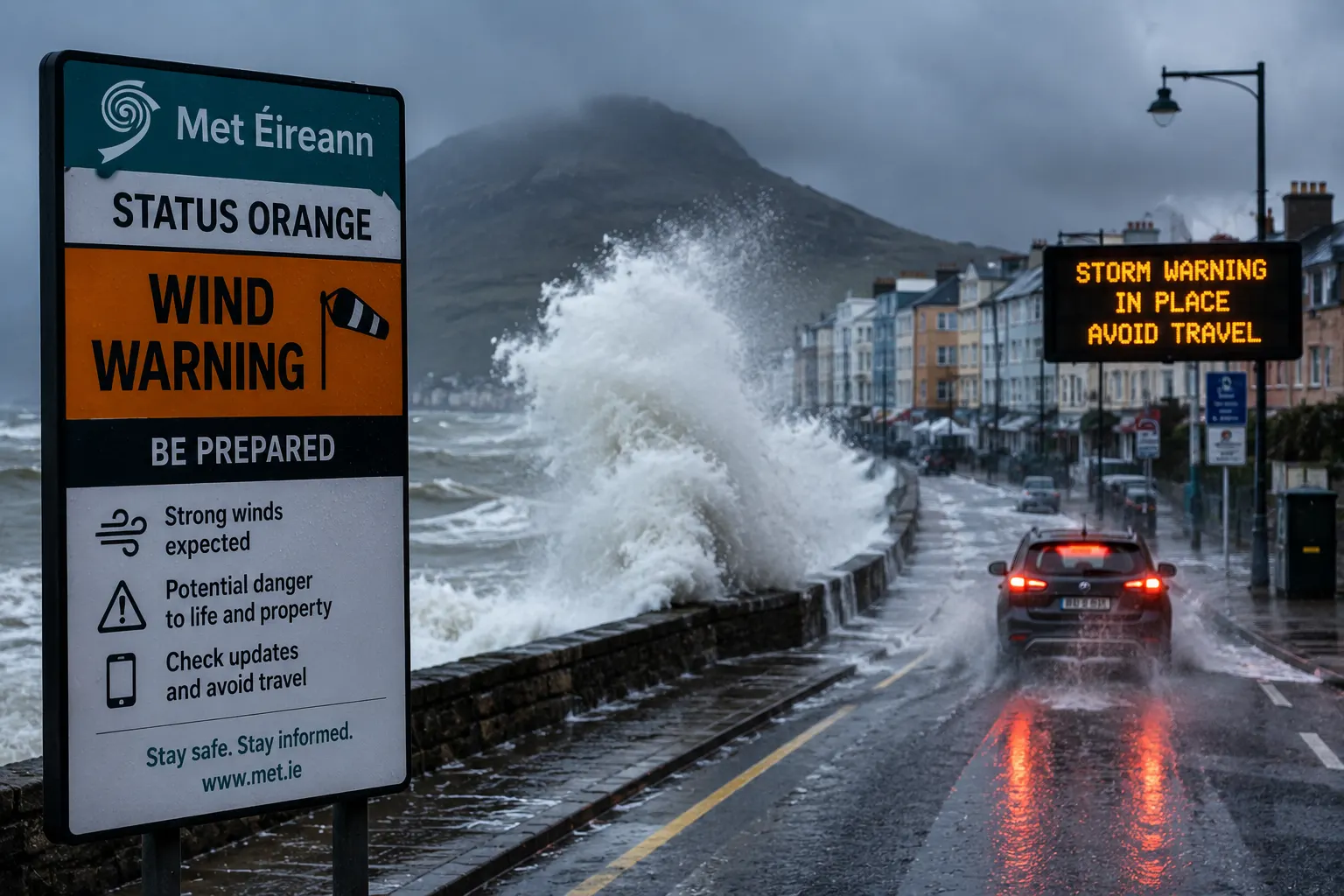
Status Orange means “Be Prepared”. Conditions are expected to have the capacity to significantly affect people, property, travel or activities within the warned area.
Status Red means “Take Action”. Red warnings are comparatively rare and indicate severe weather requiring action to protect people and property. Official emergency guidance tells the public to shelter in place during Red warnings.
The colour should never be read in isolation.
A Yellow rainfall warning can be particularly important to somebody living beside a river. An Orange wind warning may matter far more to a campervan driver, roofer, fisherman or person living beneath mature trees than to somebody inside a modern city-centre building.
Similarly, an Orange warning does not automatically produce an identical national instruction to remain indoors. During particularly dangerous Orange events, emergency authorities may advise people to restrict journeys to essential travel and shelter in place as much as possible. The exact wording issued for that storm should therefore be followed. During Red wind warnings, the instruction is much clearer: stay sheltered and do not travel unless directed otherwise by emergency authorities.
Met Éireann generally issues warnings when severe or extreme weather is expected within approximately 48 hours, while advisories can provide earlier notice of potentially hazardous conditions farther ahead.
A Named Storm Is Not the Warning
Another common misunderstanding concerns storm names.
When Met Éireann announces that a storm has been named, the name helps authorities, media and the public communicate consistently about the same weather system.
But the name itself does not tell you how dangerous conditions will be in your county.
A named storm can produce different warning levels across Ireland.
One county may receive Red.
Another may receive Orange.
Another may receive Yellow.
And a location within a warning area may experience different conditions from another location in the same county.
Met Éireann emphasises that the timing, direction of wind, previous rainfall, tides and local geography can substantially change the impact of a storm.
Your county warning and its stated impacts matter more than the storm’s name.
The First Five Things to Do When a Serious Warning Appears
When Met Éireann issues an Orange or Red storm warning for your area, preparation should begin before the strongest conditions arrive.
Charge phones and power banks. Check prescriptions and essential medical supplies. Bring loose garden furniture, bins, toys and lightweight objects indoors or secure them safely while conditions are still calm. Check where vehicles are parked and move them away from obviously vulnerable trees or known flood locations if this can be done safely. Make sure people in the household know how they will communicate if mobile or power networks fail.
Government emergency-planning guidance recommends keeping essential food and water sufficient for up to several days, maintaining access to medicines, having a battery-powered radio and torch available and keeping important documents where they can be retrieved easily.
Once dangerous winds have arrived, preparation time is over.
Do not go outside during a Red warning because a wheelie bin, trampoline, garden chair or gate was forgotten.
Property can be replaced.
A person struck by flying debris cannot.
For Residents: Prepare the House Before the Wind Arrives
People living permanently in Ireland have one advantage over visitors: they normally know their home and neighbourhood.
Use that knowledge.
If large trees surround the property, consider which rooms are least exposed.
If the road has flooded previously, assume it may do so again.
If electricity regularly fails during storms, prepare accordingly.
If the house relies on electrically powered medical equipment, heating controls or pumps, make contingency arrangements before the storm.
Close windows and doors securely. Keep away from windows during the strongest winds because debris can break glass. Do not remain in conservatories or exposed glass structures if conditions become severe.
The Office of Emergency Planning specifically advises remaining indoors when instructed, staying away from windows and avoiding trees, walls and electricity lines because all can fail during strong winds.
Check on older neighbours, people living alone and anyone whose mobility or medical needs could make a prolonged electricity failure particularly difficult. National emergency guidance repeatedly asks communities to check on vulnerable neighbours when severe weather approaches.
For Visitors: Your Holiday Plan Becomes Secondary to the Warning
Tourists face different risks because they may not know the local terrain.
A road shown by navigation software may be a narrow exposed coastal route.
A scenic viewpoint may be directly exposed to Atlantic winds.
A hotel beside an attractive harbour may stand within a coastal flood zone.
A mountain walk planned for the morning may enter conditions dramatically more severe than those in the town below.
Visitors should therefore ask accommodation staff about local risks and follow local-authority advice.
Check ferry, airline, rail and bus operators directly rather than assuming the service will operate because a ticket remains visible in an app. Severe-weather guidance specifically recommends checking transport operators because flights, ferries and public transport can be delayed or cancelled.
If a hotel asks guests to remain inside, do so.
If a ferry is cancelled, do not attempt to reach the same destination using an exposed coastal road simply to preserve the itinerary.
If an attraction, national park or coastal site closes, regard the closure as a safety decision rather than an inconvenience.
For visitors, changing plans early is usually much easier than becoming stranded after roads close.
Atlantic Ireland: Donegal, Sligo, Mayo, Galway and Clare
The western and north-western seaboard is frequently among the most exposed parts of Ireland during Atlantic storms.
Counties Donegal, Sligo, Mayo, Galway and Clare deserve particular attention when strong south-westerly or westerly winds combine with high seas.
The danger is not simply wind.
Large Atlantic waves, storm surge and high tide can combine to send water over sea walls and into exposed promenades, roads and harbour areas. During previous severe storms, official warnings have highlighted Galway, Mayo, Clare, Sligo, Leitrim and Donegal coastlines as particularly vulnerable to wave overtopping and coastal flooding.
The Irish Coast Guard’s rule for these conditions is deliberately memorable:
Stay Back. Stay High. Stay Dry.
Do not go to Salthill, Lahinch, Westport, exposed Donegal headlands or another coastal location simply to photograph the storm.
Do not stand on a pier.
Do not walk along the edge of a cliff.
Do not assume a sea wall means waves cannot reach you.
A wave capable of crossing a promenade can contain enormous force and debris.
The most spectacular place to watch an Atlantic storm is frequently the least sensible place to stand.
The West Is Also Vulnerable After the Wind Has Passed
Coastal danger does not necessarily disappear when the centre of a storm has moved away.
Heavy swell can continue.
Cliff edges can be unstable.
Roads can remain flooded.
Trees weakened rather than felled during the storm may fall afterwards.
The Coast Guard has specifically warned that exposed coastal areas can remain dangerous in the days after severe storms.
For residents and tourists alike, the first calm hour after a major storm is not an invitation to inspect the coastline.
Wait until official warnings expire and local conditions are known.
Cork and Kerry: Peninsulas, Mountains and Atlantic Exposure
Cork and Kerry combine several different storm risks.
Their Atlantic and south-western coasts are exposed to high seas and strong winds.
Their peninsulas contain long stretches of narrow, exposed roads.
Mountainous terrain can experience substantially stronger winds and heavier rainfall than nearby towns.
Rivers and streams can rise rapidly.
Remote communities may also experience lengthy electricity or communications disruption when trees damage overhead networks.
A tourist staying on the Beara, Dingle or Iveragh Peninsula should therefore think differently from somebody staying in central Cork city.
If an Orange or Red warning is approaching, consider whether you genuinely need to travel along an exposed peninsula road before conditions improve.
Do not begin hikes simply because conditions appear manageable at sea level.
Do not approach exposed cliffs or beaches.
Campers and motorhome users should pay particular attention to wind exposure. High-sided vehicles are more vulnerable to crosswinds, and the RSA and emergency authorities repeatedly identify high-sided vehicles and motorcycles as particularly exposed during severe wind events.
A visitor staying in a tent or an exceptionally exposed campsite should speak to the site operator and move to safer substantial shelter when instructed to do so.
Limerick, Clare and the Shannon: Wind Can Become a Water Problem
Around the Shannon Estuary and wider Shannon catchment, the storm problem can involve both coastal and river processes.
Strong winds and high tides can affect estuarine areas while prolonged rain across a large catchment can raise river levels later.
This is important because river flooding may peak after the strongest wind has already passed.
Someone who wakes to calmer weather should not therefore assume that the emergency is finished.
Government flood guidance identifies four principal natural sources of flooding in Ireland: rivers, the sea and tides, intense surface rainfall and groundwater.
Residents in historically flood-prone areas should follow local-authority information, move valuables upwards before water arrives and move vehicles to higher ground where this can be done well in advance and without creating additional risk.
Waterford, Wexford and the South-East: Do Not Underestimate Southerly Storms
Ireland’s south-east may be less exposed to the direct Atlantic swell than Galway or Mayo, but that does not make it storm-proof.
Waterford and Wexford, together with southern and eastern coastal communities, can experience severe conditions when winds arrive from a direction that drives water towards the coast.
High tide timing becomes particularly important.
Official emergency coordination during storms has repeatedly warned that strong onshore winds combined with high seas can produce wave overtopping, storm surge and flooding in low-lying exposed coastal areas along Ireland’s southern as well as Atlantic coasts.
Waterford city, coastal towns and communities along estuaries and rivers can therefore face a mixture of wind, river and tidal risk.
The correct response is not to use a general impression that “the worst storms hit the west”.
Use the warning for the county you are actually in.
Dublin and the East Coast: Lower Atlantic Exposure Does Not Mean Low Risk
Dublin, Wicklow, Louth, Meath and the eastern coastline often experience different exposure from the Atlantic west.
But severe storms can still bring damaging winds, flooding, transport disruption and power failures.
Dublin has an additional vulnerability: population and transport density.
A fallen tree across one rural road may affect dozens of people.
A fallen tree, flood or overhead-line problem affecting a major Dublin route can disrupt thousands.
The Irish Sea coastline can also experience dangerous conditions when wind direction, surge and tide combine unfavourably.
Residents around low-lying coastal districts should therefore pay attention to coastal flood warnings even if the Atlantic coast is receiving more dramatic television coverage.
In County Wicklow, mountains create another risk. Conditions on the Wicklow Mountains can be dramatically more severe than conditions in Dublin city.
A visitor should never use Dublin’s weather as evidence that a mountain hike in Wicklow is safe.
Dublin Tourists: Do Not Turn a Storm Into Sightseeing
Visitors staying in central Dublin are generally surrounded by substantial buildings, public transport and emergency infrastructure.
That can create a false sense that a Red warning is merely inconvenient.
During Red conditions, the official instruction remains to shelter in place.
Do not walk to the coast to see the waves.
Do not travel to Howth, Dún Laoghaire, Bray or Wicklow simply because the storm looks interesting.
Do not assume a tour bus, attraction or restaurant reservation justifies travel during a Red warning.
A cancelled afternoon is a far better outcome than becoming stranded when transport stops operating.
The Midlands: Less Sea, but Plenty of Storm Risk
Counties such as Offaly, Laois, Westmeath, Longford, Roscommon and inland parts of Kildare and Tipperary do not face Atlantic storm surge.
Their risks are different.
Fallen trees can block rural roads.
Overhead electricity lines can be damaged.
Rivers can flood.
Surface water can accumulate where drainage is overwhelmed.
Low-lying land can remain flooded long after rainfall has stopped.
The danger is particularly easy to underestimate because there may be no dramatic coastline nearby.
A river crossing an agricultural landscape can rise significantly after heavy rain upstream.
Roads that appear shallowly flooded can conceal damaged surfaces, open drains or missing manhole covers.
Official advice is unequivocal:
Never drive through floodwater. Turn around and use another route.
Cavan, Monaghan and the Border Region
Cavan and Monaghan combine inland wind and flood risks with numerous rural roads and lakes.
Strong winds can bring trees down across secondary roads, while prolonged rainfall can affect rivers, lakes and low-lying terrain.
People travelling towards Northern Ireland also need to recognise that the warning authority changes once they cross the border.
In the Republic of Ireland, Met Éireann warnings apply.
In Northern Ireland, official severe-weather warnings come through the UK Met Office and Northern Ireland public authorities.
Visitors crossing the border during severe weather should therefore check both systems rather than assuming one warning map covers every part of the island. Northern Ireland also uses Yellow, Amber and Red weather warnings rather than Ireland’s Yellow, Orange and Red terminology.
Mountains and High Ground: A Separate Risk Zone
County boundaries tell only part of the story.
High ground deserves its own category.
The Wicklow Mountains, MacGillycuddy’s Reeks, mountains of Kerry and Cork, Connemara, Mayo, Donegal and the Comeragh Mountains can experience conditions significantly worse than sheltered towns nearby.
Wind accelerates across exposed ridges.
Rain can reduce visibility.
Streams can rise.
Mountain rescue becomes more difficult and dangerous during storms.
An Orange warning should therefore trigger serious reconsideration of hiking and climbing plans, even if the morning is relatively calm.
During a Red warning, the decision is straightforward:
do not go.
For holidaymakers, the mountain will still be there after the storm.
Islands and Ferry-Dependent Communities
Ireland’s inhabited islands face another form of vulnerability.
A storm can interrupt access before conditions on the island themselves become extreme.
Ferries may stop.
Supplies can be delayed.
Visitors can find themselves unable to leave when planned.
Island residents are accustomed to these realities, but tourists may not be.
If staying on an offshore island while a significant storm is forecast, speak to the accommodation provider and ferry company early.
Do not assume the final scheduled sailing will operate.
Equally, do not pressure a skipper to sail because of a flight or hotel booking.
Marine warnings exist because sea conditions can become dangerous even when the weather appears manageable on land.
Marine Warnings Are Different From County Warnings
Met Éireann publishes marine warnings separately from ordinary county weather warnings.
A coastal county may not have the highest land warning while adjacent waters are experiencing serious marine conditions. Met Éireann separately issues Small Craft, Gale, Storm and other marine warnings for Irish coastal waters.
Anyone fishing, sailing, kayaking, surfing or operating a small craft should therefore check the marine forecast and warnings, not merely the weather icon for the nearest town.
If somebody is in danger on or beside the water, call 112 and ask for the Coast Guard, or use Marine VHF Channel 16 where available.
Coastal Rule: Stay Back, Stay High, Stay Dry
Few pieces of Irish emergency advice are more important.
Stay Back from the water.
Stay High above exposed low-lying coastal locations.
Stay Dry rather than entering water or flooded areas.
The Coast Guard applies that advice to coastal regions and inland waterways during storms.
A photograph of a wave is not worth risking your life.
Neither is retrieving a dog that has been deliberately allowed off a lead beside storm seas. Keep pets restrained before approaching any coastal area — and preferably avoid the area entirely while warnings are active.
If another person enters difficulty in the sea, do not automatically enter the water yourself.
Call 112 and ask for the Coast Guard.
Driving: The Most Common Decision That Can Be Avoided
For many people, the hardest storm decision is whether to drive.
A car creates an illusion of protection.
But severe wind and floodwater introduce hazards the vehicle cannot control.
The Road Safety Authority advises drivers in heavy rain to reduce speed, increase the distance to the vehicle ahead and expect reduced visibility and aquaplaning. Spray from large vehicles can temporarily remove almost all forward visibility.
Strong winds create another problem.
A gust can push a car sideways, particularly when it exits the protection of buildings or hedges, crosses a bridge or overtakes a large vehicle.
Motorcycles, bicycles, caravans, vans, trucks and other high-sided vehicles are especially vulnerable. Official storm guidance specifically warns drivers to anticipate crosswinds, fallen trees and debris.
If authorities advise against travel, postpone the journey.
During a Red warning, shelter in place.
Never Drive Through Floodwater
The rule deserves its own section because drivers repeatedly underestimate water.
You cannot accurately judge depth from the driver’s seat.
You cannot see whether the road surface has collapsed.
You cannot see an open manhole.
And flowing water exerts substantial lateral force against a vehicle.
Irish government emergency guidance repeatedly states:
Do not drive through floodwater. Turn back and find another route.
The same principle applies on foot.
Do not walk, cycle or attempt to swim across rapidly flowing floodwater.
It may be contaminated and can conceal hazards beneath the surface.
If Your Home Is at Risk of Flooding
Preparation needs to happen before the water reaches the door.
Move valuable possessions and essential documents above the expected flood level.
Move a vehicle to higher ground if there is sufficient warning and it is safe to do so.
Have essential medicines, warm clothing, food and drinking water ready.
Be prepared to leave if emergency services order an evacuation.
Government flood guidance also recommends residents in known flood-risk areas develop a household flood plan before an emergency occurs rather than improvising when water begins rising.
If officials tell you to evacuate, leave.
Do not remain solely to protect possessions.
Power Cuts: Expect Them During Major Windstorms
Trees, branches and flying debris can damage Ireland’s electricity network.
A severe storm can therefore leave homes without electricity for hours or, during very widespread network damage, longer.
Charge mobile phones before the storm.
Keep torches available.
Know whether heating, pumps, medical equipment or cooking appliances depend on electricity.
ESB Networks advises people never to approach fallen power lines or damaged poles and to assume every fallen wire is live. The emergency number for ESB Networks is 1800 372 999.
Do not touch the wire.
Do not move it.
Do not attempt to drive over it.
Keep children and animals away.
Report it.
What to Do Inside During a Power Cut
If electricity fails while appliances such as an electric cooker, oven or iron are operating, switch them off so they do not create a hazard when supply returns.
ESB Networks recommends leaving one light switched on so the restoration of electricity is immediately apparent. It also urges particular caution with candles and other naked flames.
Battery-powered lights are preferable where available.
Keep refrigerators and freezers closed as much as possible.
Do not run petrol or diesel generators indoors or in enclosed spaces.
Water Supply Can Also Be Affected
Storms can interrupt pumping and treatment systems, damage infrastructure or reduce pressure.
Uisce Éireann operates a 24-hour customer service line on 1800 278 278 and provides local supply updates and a text-alert service.
Residents dependent on water for medical or other essential purposes should prepare before a major warning where possible.
Holidaymakers staying in self-catering accommodation should follow instructions from the accommodation provider if a local water advisory or outage occurs.
If You Smell Gas
A storm can damage structures and utilities.
If you smell gas, Gas Networks Ireland operates a 24-hour emergency line on 1800 20 50 50.
Official guidance says not to smoke, vape or use a naked flame, and not to operate electrical switches or plugs. Open windows and doors where safe and follow Gas Networks Ireland’s instructions.
This is one situation where the instinct to switch a light on can create additional danger.
Children During a Storm
Children often experience storms very differently from adults.
The sound of wind, loss of electricity and emergency warnings can be frightening.
Explain what is happening without making the event unnecessarily dramatic.
Keep children indoors during severe conditions.
Do not allow them to play near swollen rivers, floodwater, fallen trees or storm-damaged structures afterwards.
The temptation to “go and see the flooding” should be resisted.
Government flood guidance warns that riverbanks can become unstable and floodwater can contain hidden hazards.
Families should also agree beforehand who collects children if schools or childcare facilities close early because of a developing storm. National emergency-planning advice specifically recommends households establish communication and collection arrangements in advance.
Older People and People With Medical Needs
A three-hour power outage is an inconvenience for many people.
For someone dependent on electric medical equipment, refrigerated medication, an electrically powered mobility aid or a home-care visit, it can become a medical problem.
Households should identify those dependencies in advance.
Keep medicines accessible.
Keep phones charged.
Ensure carers and relatives know the severe-weather plan.
If somebody’s health becomes endangered, use the emergency services rather than waiting for electricity restoration.
Pets
Bring pets into secure shelter before severe winds arrive.
Do not leave dogs outdoors where fencing or gates may fail.
Keep animals away from fallen electricity lines and floodwater.
During coastal storms, keep dogs on a lead well away from the shoreline.
Attempting to rescue a pet from rough water has repeatedly placed people themselves in danger; the safer principle is preventing the animal from entering the hazard area in the first place.
Farmers and Rural Residents
Rural households can face longer access routes, exposed roads and overhead electricity networks.
Before conditions deteriorate, secure movable equipment and consider animal welfare.
Do not begin outdoor repairs once dangerous winds have started.
After a storm, treat fallen electrical wires across fields or roads as live and report them to ESB Networks.
Trees leaning against wires are also dangerous.
Do not attempt to clear them yourself.
What Status Yellow Should Change
Yellow does not mean “nothing to worry about”.
It means be aware of the activity and location that place you at risk.
For most people in a secure building, daily life may continue.
For somebody planning to kayak off Mayo, climb Carrauntoohil, tow a caravan, drive a truck across an exposed bridge or work at height, the same Yellow warning may require a significant change of plan.
Read the impacts.
Ask whether your planned activity exposes you to precisely the hazard described.
If it does, alter the activity.
What Status Orange Should Change
Orange means the weather has the capacity to create significant impacts.
Prepare the property.
Charge devices.
Reconsider unnecessary journeys.
Cancel exposed outdoor activity.
Keep away from coasts where high seas are expected.
Check transport.
Follow local authorities and emergency services.
During particularly dangerous Orange storms, national authorities may recommend limiting journeys to essential travel and sheltering as much as possible.
Do not create your own rule based solely on the colour: read the actual warning text.
What Status Red Should Change
Red means Take Action.
Ireland’s emergency guidance tells the public to shelter in place during Red warnings.
That means a restaurant booking is irrelevant.
A planned drive can wait.
The dog walk can wait.
The photograph can wait.
The grocery trip can wait.
The storm is not the time to discover whether your car can handle the wind.
Emergency and essential personnel operate under their own procedures. Everyone else should follow official instructions and remain in safe shelter until the warning expires or authorities say otherwise.
If You Are Staying in a Campervan, Caravan or Tent
Visitors travelling around Ireland by campervan or caravan need to take wind warnings especially seriously.
These vehicles present large surfaces to crosswinds and may be parked in exposed coastal locations precisely because those places are attractive in normal weather.
Move before the storm, not during it.
Avoid cliff-top, harbour-front or flood-prone parking.
Follow campsite instructions.
If authorities or accommodation operators advise moving to substantial shelter, do so while travel remains safe.
A tent should never be treated as equivalent to a building during severe winds.
Changing accommodation for one night may be frustrating.
It may also be the safest decision of the holiday.
If Your Flight or Ferry Is Cancelled
Do not travel towards a port or airport without checking the operator first when significant weather warnings are active.
Roads may be more dangerous than the terminal itself.
A flight cancellation does not justify travelling through Red warning conditions to reach a hotel elsewhere.
A ferry cancellation does not justify searching for an alternative exposed harbour.
Allow the transport operator and accommodation provider to help rearrange the journey once conditions improve.
Northern Ireland official guidance similarly advises passengers to check airlines and ferry companies directly during severe weather because delays and cancellations can occur.
If You Become Stranded in a Vehicle
If travel becomes impossible, do not automatically leave the vehicle and walk through dangerous winds or floodwater.
Assess where the immediate hazard lies.
If floodwater is rising around the vehicle or there is another immediate threat to life, call emergency services.
If you are safe where you are, contact assistance and provide the clearest possible location.
In Ireland, an Eircode or precise location from a phone can be extremely helpful.
Do not leave a secure position solely because reaching the destination feels urgent.
The Emergency Numbers to Know
For immediate danger in the Republic of Ireland, call 112 or 999 for Gardaí, ambulance or fire services.
For an emergency at sea or on the coast, call 112 or 999 and ask for the Coast Guard. Marine users can also call the Coast Guard through VHF Channel 16.
ESB Networks emergency service for fallen wires and electricity faults: 1800 372 999.
Uisce Éireann 24-hour customer care: 1800 278 278.
Gas Networks Ireland 24-hour emergency service: 1800 20 50 50.
For local flooding, blocked roads and community information, monitor and contact the relevant local authority. During severe weather, local authorities activate emergency arrangements and publish road closures, flooding information and local instructions.
If Travelling Into Northern Ireland
Visitors should be aware that service arrangements change across the border.
Northern Ireland uses UK Met Office Yellow, Amber and Red warnings.
Emergency services can still be reached on 999 or 112.
The Northern Ireland Flooding Incident Line is 0300 2000 100, and NIE Networks can be contacted on 03457 643 643 for power faults.
This distinction is particularly relevant to tourists travelling between Donegal and Derry, Cavan and Fermanagh, Monaghan and Armagh or Louth and Down.
Do Not Rely on Social Media Rumours
Storms generate large amounts of unofficial information.
Photographs from earlier storms are sometimes reposted as current.
Road closures change.
Warnings are updated.
Rumours spread rapidly.
Use Met Éireann for weather warnings, local authorities for local road and flood information, ESB Networks for electricity restoration information, Uisce Éireann for water services and official transport operators for services.
Social media can be useful when those organisations use it themselves.
Anonymous posts should not override official information.
Why Local Authority Updates Matter
A national weather warning cannot tell you that a particular bridge has closed or that a road outside one village is flooded.
Local authorities can.
During severe storms, councils may close roads, deploy flood barriers, manage fallen trees and coordinate with emergency services.
Government guidance specifically directs the public to local-authority websites and official social-media channels for road closures, flood updates and community alerts.
For residents, it is worth knowing the local authority before a storm arrives.
For visitors, the county written on the accommodation address tells you which authority to search for.
What to Do After the Warning Expires
The expiry time is not a switch that instantly removes every hazard.
Trees may remain unstable.
Power lines may still be down.
Roads may remain flooded.
Rivers may continue rising.
Coastal swell may remain dangerous.
Emergency crews may still be clearing debris.
Before travelling, check the route.
Do not move barriers or bypass road-closure signs. Government emergency advice specifically warns that a closed flooded road may have damage hidden beneath the water.
Never approach a fallen wire.
Keep away from damaged trees and buildings.
Give emergency and utility crews room to work.
After Flooding, Water Itself May Be Hazardous
Floodwater can contain sewage, chemicals, animal waste and other contamination.
Government guidance advises avoiding contact where possible and warns that hazards such as uncovered manholes may be invisible beneath the water.
Do not allow children to play in floodwater.
Do not assume a shallow flooded street is safe to walk through.
If a property has been flooded, follow local-authority and utility guidance before restoring electricity or using affected appliances.
Residents Should Build a Storm Plan Before Storm Season
The best emergency plan is created on a calm day.
Know who checks on older relatives.
Know who collects children.
Know where torches are.
Know where medicines are.
Know how to turn off utilities if necessary.
Know whether the house has flooded before.
Know which road provides an alternative route.
Know where the family will communicate if mobile service fails.
The Office of Emergency Planning specifically recommends agreeing family communications, a meeting point and responsibility for children and vulnerable relatives before an emergency develops.
Preparation does not require panic buying.
It requires eliminating the small problems that become large ones at 2am during a power failure.
Tourists Need a Smaller Emergency Plan
Visitors do not need to prepare a house for an Irish winter.
They do need to know where they are.
Save the accommodation address.
Know the county.
Keep the phone charged.
Keep essential medication with you.
Do not allow a rental car to run nearly empty if a major storm is forecast and extensive travel may be required before conditions deteriorate.
Ask where the safest part of the accommodation is if conditions become severe.
Check whether the next day’s transport is operating.
And know that 112 and 999 work for emergency assistance.
The greatest tourist vulnerability is often unfamiliarity rather than the storm itself.
A Practical Storm Checklist
- Check the current Met Éireann warning for your county and read the stated impacts, not only the colour.
- Check marine warnings separately if you will be near or on the sea.
- Charge phones and power banks before conditions worsen.
- Keep torches, essential medicines, drinking water and basic food available.
- Secure loose outdoor objects while it is still safe to do so.
- Move vehicles away from known flood areas and obviously vulnerable trees before the storm, if safe.
- Reconsider unnecessary travel during Orange warnings and follow any event-specific restrictions.
- Shelter in place during Red warnings.
- Stay away from beaches, cliffs, piers, harbours and exposed promenades during severe coastal weather.
- Never walk, cycle or drive through floodwater.
- Treat every fallen electricity wire as live and stay well clear.
- Check local-authority information for road closures and flooding.
- Check directly with airlines, ferry companies and public-transport operators before travelling.
- Check on older neighbours, people living alone and anyone with medical or mobility needs.
- Keep children and pets away from rivers, floodwater and storm-damaged areas.
- After the storm, wait for official information before travelling into affected areas.
Ireland’s Storm Risk Is Regional — but the Rule Is National
An Irish storm does not affect every county in the same way.
The Atlantic west may face enormous seas.
Cork and Kerry may combine mountain rain with coastal wind.
The Shannon basin may experience delayed river flooding.
The south-east can face damaging southerly winds and tidal flooding.
Dublin can suffer transport disruption affecting hundreds of thousands of journeys.
The Midlands can experience blocked roads, river flooding and widespread electricity failures without seeing a single Atlantic wave.
Mountain areas can become hazardous even while nearby towns appear relatively calm.
And offshore islands may become isolated because ferries stop before conditions ashore become extreme.
That is why regional awareness matters.
But one rule applies everywhere:
the official warning for the place where you actually are takes priority over assumptions about where storms are normally worst.
For Visitors, Ireland Is Still Safe to Explore — but the Weather Must Be Respected
Storm warnings should not make travellers afraid of visiting Ireland.
Severe-weather systems exist precisely so people can change their behaviour before conditions become dangerous.
Most warnings pass without the worst possible impacts occurring at every location.
That does not make the warning unnecessary.
It means preparation worked and exposure was reduced.
A visitor who loses one day of a Wild Atlantic Way itinerary because an Orange warning makes coastal travel unwise has not ruined the holiday.
They have made a sensible decision that allows the holiday to continue afterwards.
The Most Dangerous Decision Is Often the Unnecessary One
Major storms create dramatic hazards, but many individual risks arise from ordinary choices.
Going to photograph waves.
Driving home because the journey is familiar.
Crossing a flooded road because another vehicle made it through.
Walking underneath trees because the wind seems to be easing.
Retrieving an object from the garden during a Red warning.
Beginning a mountain hike because the sky still looks clear.
Those decisions are avoidable.
Ireland’s emergency system cannot remove the wind or stop the Atlantic.
Its purpose is to give people enough information to avoid placing themselves in the path of those hazards.
The Rule to Remember When the Next Storm Arrives
When the warning is Yellow, be aware.
When it turns Orange, be prepared and change plans where necessary.
When it turns Red, take action and shelter in place.
At the coast:
Stay Back, Stay High, Stay Dry.
On flooded roads:
Turn around.
Around fallen electricity lines:
Stay away and report them.
And if somebody’s life is in immediate danger:
call 112 or 999.
For residents, good preparation means the storm becomes something managed from a safe home rather than improvised in the middle of an emergency.
For visitors, it means understanding that an itinerary can be changed but severe weather cannot be negotiated with.
Ireland has spent years building a warning and emergency-response system around exactly that principle.
The safest response to a storm warning is not fear. It is to understand the warning early enough that you never have to test how dangerous the storm can become.
Source & Transparency
This article is published by Ireland Newspaper for editorial and informational purposes.
Published: 12 August 2026 · Updated: 12 August 2026

Newsroom Ireland Newspaper
Ireland Newspaper editorial team prepares daily news coverage for readers in Ireland and abroad.